
Precip offers highly accurate, site-specific rainfall accumulation data
- Official site ↗
- Check out our demo to see it in action.
Are you using rainfall data to make decisions for your business? Book a live demo to see how Precip can improve your operation.
Try our API now

Why Precip?
Rainfall is highly variable, even over small distances. It's not uncommon for one location to get multiple inches of rain, while another location just 10 minutes away gets almost none. If you're operating large machinery, planning a fleet deployment, or using rain data to make agronomy decisions, this can make a huge difference to your operation.
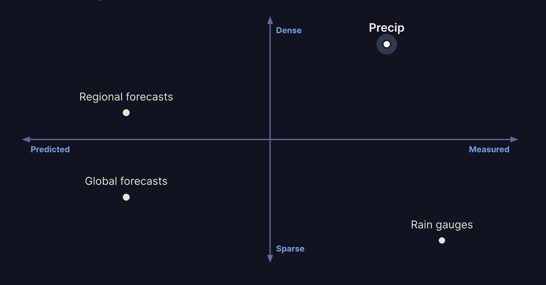
Precip rain accumulation data is not a forecast—it's a precise estimate of actual rainfall based on remote observation. Using high-precision, remotely-sensed rainfall data gives you gauge-level rainfall precision for as many locations as you need, without the hassle of installing and maintaining your own rain gauges.
Key features
- Highly accurate — Our models offer the most accurate rainfall estimates available.
- Site-specific — Our data is available at 0.6-1.2km resolution, so you can get the precise measurement you need.
- Observations, not forecasts — Our data is based on remote observation of real precipitation, not forecasting models.
Available endpoints
Browse the full API docs →
How it works
We use local, high-resolution data calibrated using tens of thousands of gauges as well as satellite and radar data not available when forecasts were made. We then use machine learning to combine and calibrate the data into the most accurate precipitation estimates available.

Coverage
Currently we support the entire US lower 48. We're working on expanding coverage to parts of Canada, Mexico, and the rest of the world.
Pricing
Contact us for pricing details →
Legal
Usage of the Precip API is subject to our Terms of Service.
Contact
For questions, comments, or feedback, please email [email protected].